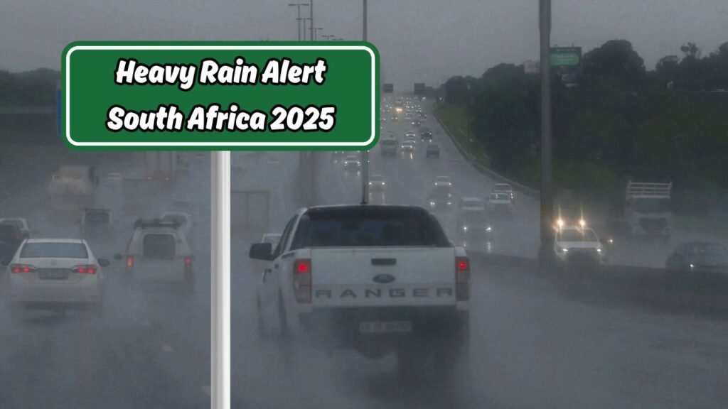
Weather Alert 2025 : South Africa is bracing for a significant weather shift as a strong cold front approaches, bringing with it heavy rainfall, gusty winds, and a notable drop in temperatures. According to the South African Weather Service (SAWS), the system is expected to make landfall along the western coastline before sweeping inland over the next few days. Coastal towns are predicted to experience the first wave of intense showers, with inland provinces feeling the impact soon after. Communities are advised to prepare for possible flooding, particularly in low-lying areas where water drainage is poor. The combination of saturated soils from recent rains and this new influx of precipitation could lead to dangerous road conditions and potential disruptions in transportation. Farmers are being urged to take precautionary measures to protect crops and livestock from both the heavy rains and the cold temperatures that will follow. Meanwhile, authorities are coordinating with disaster management teams to ensure readiness for any emergencies. Residents are encouraged to secure outdoor items, check that gutters are clear, and stay updated with official weather advisories.

Regions Most Affected by the Incoming Cold Front
The upcoming cold front is forecast to have the most pronounced effects on the Western Cape, Northern Cape, and Eastern Cape provinces. In the Western Cape, Cape Town and surrounding coastal communities can expect sustained heavy rains and strong winds exceeding 50 km/h, which could cause localized flooding and damage to infrastructure. The Northern Cape, while generally dry, will experience significant rainfall in its southern areas, potentially leading to flash flooding in normally arid zones. Eastern Cape regions, especially those along the Wild Coast, will also see intense showers and thunderstorms. The drop in temperatures across these provinces will be sharp, with daytime highs expected to be 5–8°C lower than average for this time of year. Mountain passes such as the Hex River Pass and Outeniqua Pass may become hazardous due to reduced visibility, slippery surfaces, and even possible snow accumulation. Coastal fishermen are advised to remain onshore, as high swells and rough seas will pose serious risks. In urban areas, stormwater systems may be overwhelmed, increasing the chance of street flooding. Rural areas could face challenges in accessibility as unpaved roads turn muddy and difficult to navigate.
Safety Precautions for Residents in Impacted Areas
Authorities are strongly advising residents in the path of this severe weather to take proactive safety measures. First, securing all loose outdoor objects—such as garden furniture, tools, and bins—can prevent them from being blown around by strong winds. Secondly, ensuring that roofs, gutters, and drainage channels are clear of debris will help reduce the risk of water buildup and flooding. Families should prepare emergency kits that include bottled water, non-perishable food, flashlights, batteries, blankets, and essential medications. For those living in flood-prone zones, having a clear evacuation plan and knowing the nearest shelter locations is crucial. Motorists are urged to drive cautiously, avoiding flooded roads and reducing speed to prevent accidents in slippery conditions. Farmers should move livestock to higher ground and secure feed supplies against potential water damage. In addition, residents are encouraged to stay indoors during periods of intense rain or wind, only venturing out when absolutely necessary. Communication is key—keeping phones charged and tuned in to radio or official online channels will ensure that people receive timely updates. Parents should take extra care to keep children away from swollen rivers, streams, and stormwater drains, which can become dangerous during heavy rainfall.

Potential Agricultural Impact and Economic Implications
The incoming heavy rains and cold front could have mixed consequences for South Africa’s agricultural sector. On the positive side, the substantial rainfall will help replenish water reserves in dams and reservoirs, benefitting long-term irrigation needs. However, the immediate effects on certain crops could be damaging, especially for fruit and vegetable farms in their growing phase. Excess moisture can cause root rot, fungal diseases, and spoilage, particularly in water-sensitive crops. Wheat and barley farmers may see slower growth due to the sudden temperature drop, while livestock farmers face the challenge of ensuring animals remain warm, dry, and adequately fed. Transport delays caused by flooded roads could further disrupt the agricultural supply chain, affecting delivery schedules to markets and processing facilities. In rural areas, where farming is the main livelihood, even temporary disruptions can have lasting financial impacts. Additionally, fishing industries along the coastline will likely see a temporary halt in operations due to unsafe sea conditions, leading to reduced catch volumes and potential income loss. Economists note that while the agricultural sector is accustomed to weather variability, sudden extremes—especially in close succession—can strain both production and market stability.

Expected Timeline and Ongoing Monitoring Efforts
Meteorological forecasts indicate that the cold front will begin making landfall along the Western Cape coast late Tuesday night, with the heaviest rains arriving by Wednesday morning. By Thursday, the system is expected to move inland, spreading heavy showers across the Northern and Eastern Cape before reaching KwaZulu-Natal. Rainfall intensity is predicted to peak over a 24-hour period, followed by lingering showers and cold conditions into the weekend. Snowfall in mountainous areas could begin as early as Wednesday evening, particularly in the Cederberg, Sneeuberg, and Drakensberg ranges. The South African Weather Service will be issuing regular updates every six hours to track the storm’s progress and adjust warnings as needed. Local municipalities are on high alert, with emergency teams pre-positioned in areas most at risk. Residents are encouraged to monitor official channels, as forecast models may shift depending on changes in wind direction, ocean temperature, and atmospheric pressure. In addition to rainfall warnings, wave height alerts for coastal areas will be updated to keep fishing and shipping industries informed. The monitoring effort will continue even after the front passes, as flooding risks often persist due to delayed water runoff into rivers and dams.